Ngangla

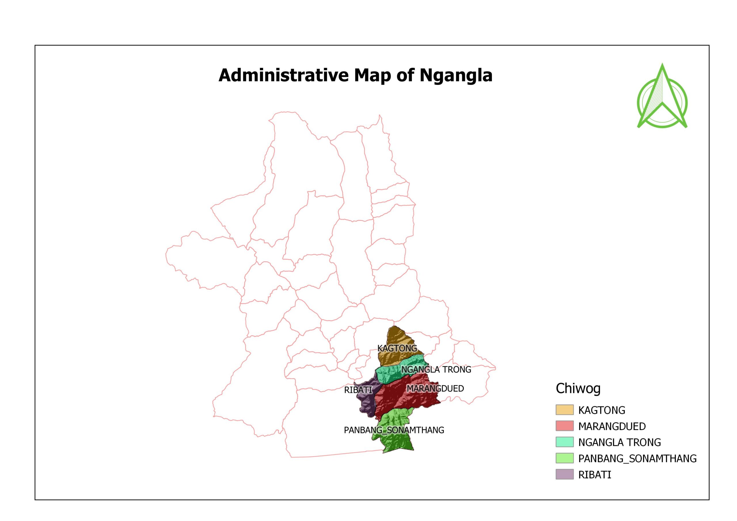
Discover the beauty of Ngangla Gewog along the Panbang–Nganglam Highway—rich in culture, scenic landscapes, and vibrant communities. Experience traditional lifestyles, thrilling white-water rafting at the confluence of the Mangde Chhu and Drangme Chhu forming the Manas River, as well as eco-tourism and sustainable farming in this serene part of Bhutan. The Gewog Centre is located approximately 115 km by road from the Dzongkhag Administration.
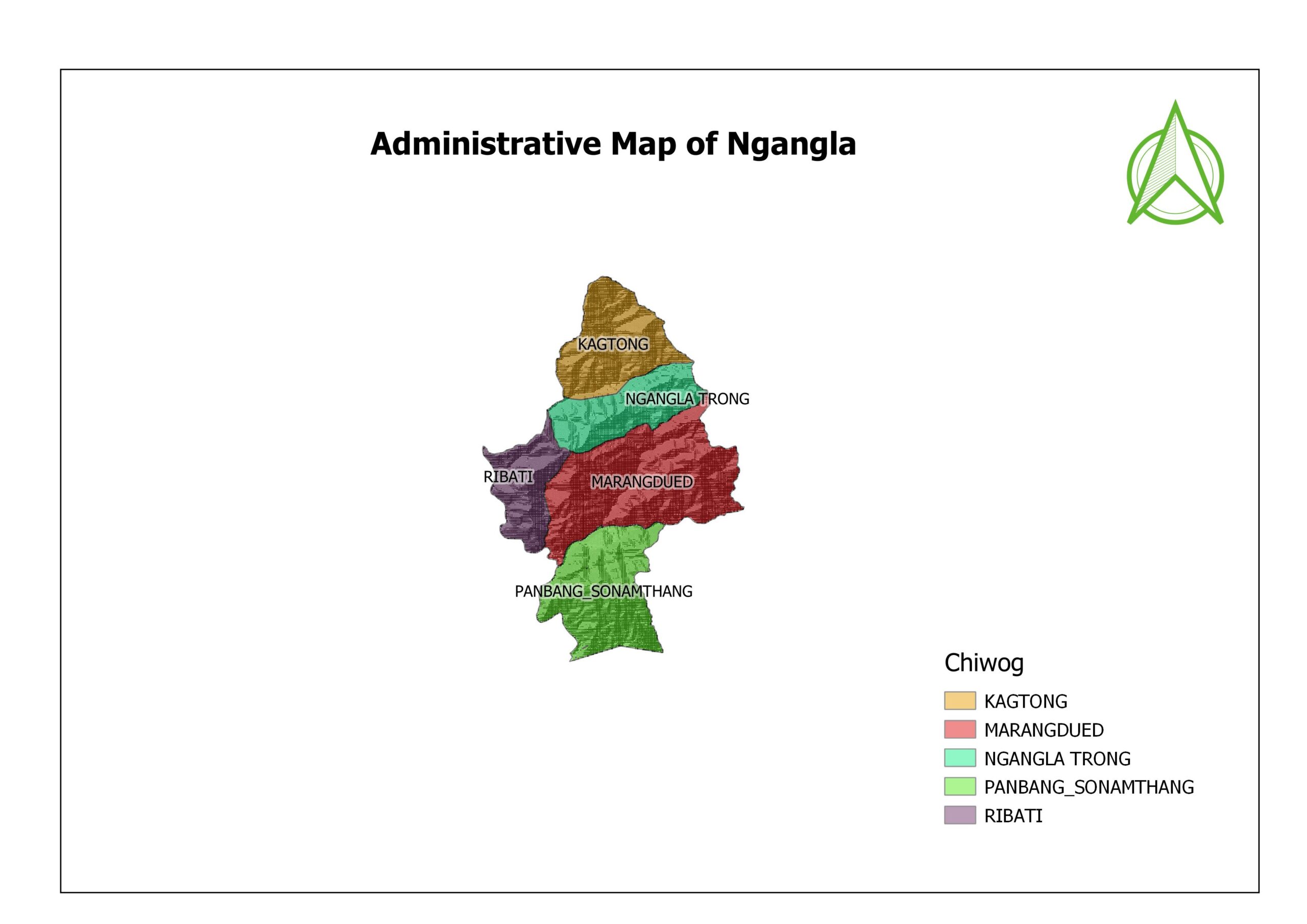
Ngangla, Gewog at a Glance, 2026

The detailed information about the Gewog:

Area: 315 Sq Km

Population: 4420

Households: 480

Gungtong: 17 ( Kaktong- 11, Repati – 3, Sonamthang- 2, NganglaTrong- 1 )

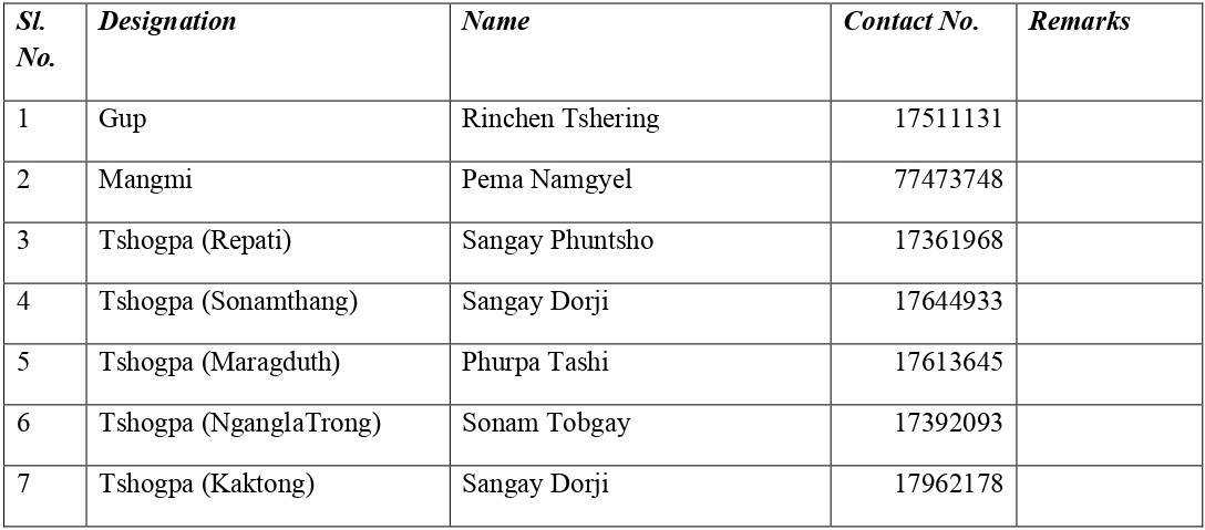
Local Government Officials:

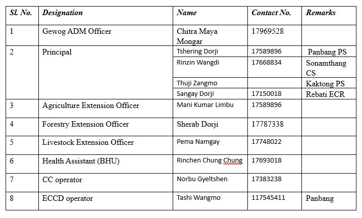
Civil Servant:

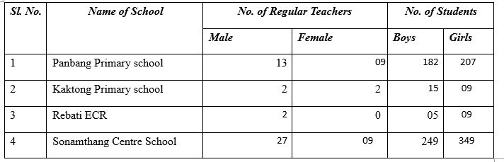
Education:

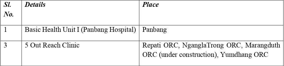
Health:

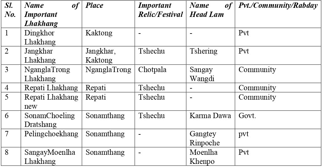
Lhakhang:

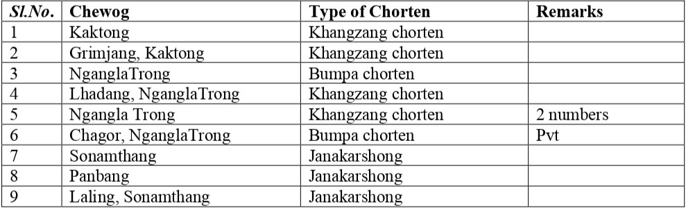
Chortens:

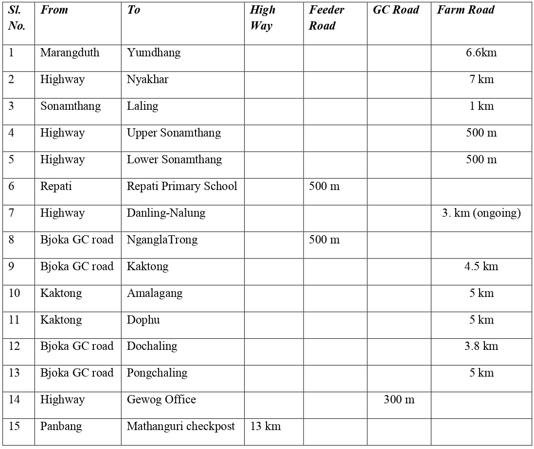
Road Connection:

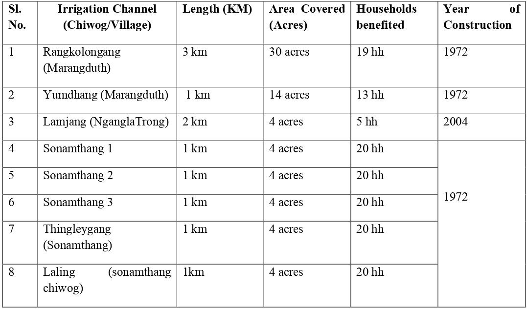
Irrigational Channels:

Electrical Fencing:

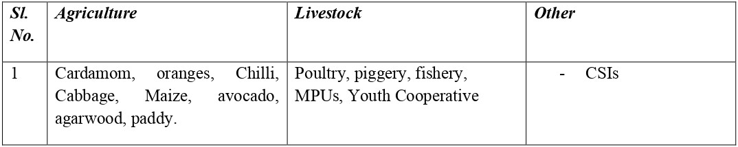
Economic Activities:

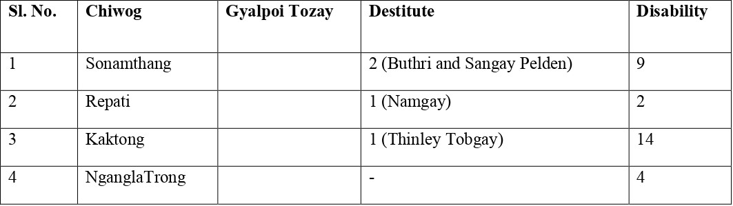
Destitute:

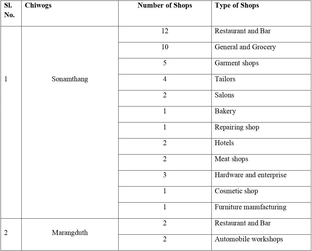
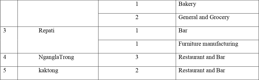
Business Activities:

 RNRC : Agriculture, Forestry and Livestock Extension services are provided from the Gewog Centre.

24/7 safe drinking water: 98% coverage

Tele-commutation : 100% coverage by both B mobile and T cell 

Electricity: 100% connected 

Compiled By: Chitra Maya Mongar (GAO)

As of April 3, 2026

Rinchen Tshering

Gup-Ngangla Gewog

Email

Phone No

Close Search Window